The hidden power of ocean currents
Research into swirling ocean eddies may help cargo ships cut carbon emissions – powered by a blend of AI and satellite data.

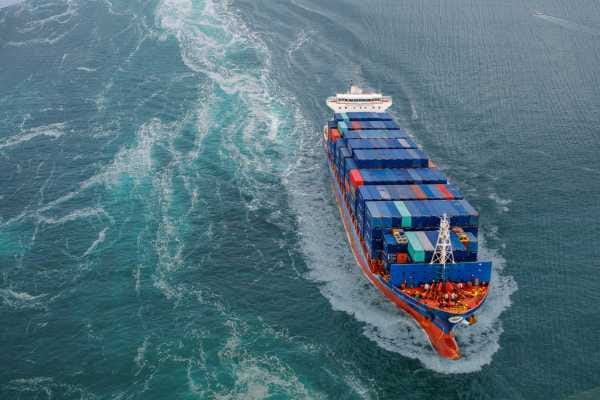
A University of NSW researcher has developed an AI-powered routing system to help commercial ships travel more efficiently.
The technology is the result of 15 years of research and aims to equip vessels with the tools to navigate in alignment with ocean currents, offering a new way to cut maritime emissions.
The research was led by UNSW oceanography and applied mathematics expert Associate Professor Shane Keating, and now underpins a new university spinout, CounterCurrent, which plans to deliver high-resolution ocean forecasts to the global shipping industry.
“With better ocean forecasts, ships can use the power of currents as they travel, reducing fuel use and cutting emissions,” Keating says.
The CounterCurrent system uses satellite data to account for powerful but under-modelled ocean features known as eddies, he says, which are swirling currents that make up 90% of the ocean’s kinetic energy.
"With better ocean forecasts, ships can use the power of currents as they travel, reducing fuel use and cutting emissions."
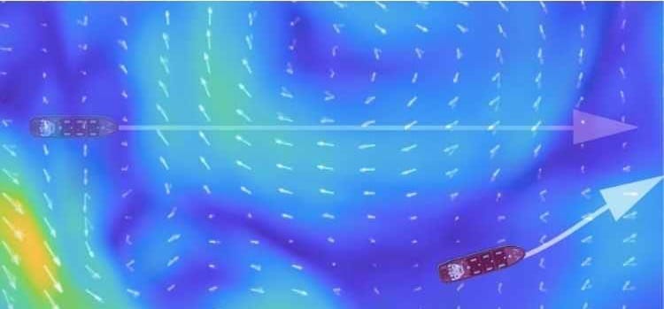
While most ships currently follow “great circle” routes – the shortest distance between two points on a sphere – this often means travelling against ocean currents, Keating says, leading to higher fuel burn.
The new routing method instead factors in real-time current data, allowing vessels to make minor route changes to conserve fuel, he says.
The shipping industry accounts for over 80% of the world's trade volume and nearly 3% of global greenhouse gas emissions, according to UN Trade and Development. The International Maritime Organisation, meanwhile, has set a target of zero emissions from shipping by 2050.
According to UNSW, tests of the new routing method across more than 100 commercial vessels have consistently shown fuel savings of up to 20 per cent.
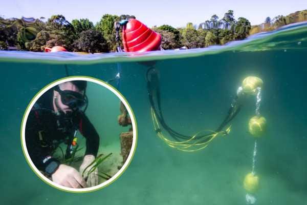
The Australian working group for the Surface Water and Ocean Topography (SWOT) satellite is a joint US-French mission also led by Keating that maps ocean currents with a higher resolution than previous technologies.
“In the past few decades, satellite technology has completely revolutionised the way we look at the ocean,” Keating says.
The SWOT team has validated satellite data by collecting ocean measurements on CSIRO’s research vessel RV Investigator and commercial cargo voyages under the 'Ships of Opportunity' Program, he adds.
“It’s a win-win for shipping companies. They can save money and meet their emissions reductions targets right now, without any modification to the vessel or change in the vessel transit time.”
The CounterCurrent routing system combines artificial intelligence with satellite-derived ocean images using an algorithm that focuses on better identifying and predicting ocean eddies which are large, circular currents that behave like underwater storms. While these eddies are poorly accounted for in standard shipping models, researchers say they play a major role in ocean dynamics due to their momentum and scale. By calculating the most current-efficient routes in real time, the system allows ships to adjust their paths slightly, increasing fuel efficiency without changing speed or equipment.